There is plenty of scope for exploring in the Castle Hill Basin and further afield. A number of areas are highlighted in the maps below. Click on the maps to explore the areas further in a popup fully interactive map. A lot of the tracks in Thomas Bush and Craigieburn Forest are multi-use, so please be considerate to other track users.
The Castle Hill Community Association have a formal agreement with DoC surrounding the track network now known as the Craigieburn Trails, with the aim that 40+ kilometres of dual-use tramping/biking tracks will be available in the Castle Hill Basin/Craigieburn Forest Park. For more information (routes, track status, etc), see the Craigieburn Trails website.
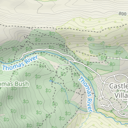
The Castle Hill Community Association started off their collaboration with DoC by creating this beautiful 8km intermediate mountain-bike/mixed-use track from the village through the native beech forest and open flats of Thomas Bush and Craigieburn Forest to Texas Flat on the Mt Cheeseman access road. The track is well-benched with quite a number of well constructed culverts and bridges, and offers plenty of diverse views of the Castle Hill Basin.
Thomas Bush Tracks
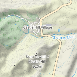
There are a number of pleasant shorter walks directly accessible from the village through the native beech forest of Thomas Bush.
These include:
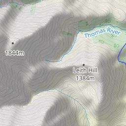
- Leith Hill Track,
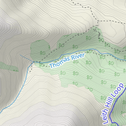
- Thomas River & Thomas Bush Tracks,
- Beech Forest Logging Track,
- Water Intake Track.
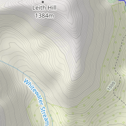
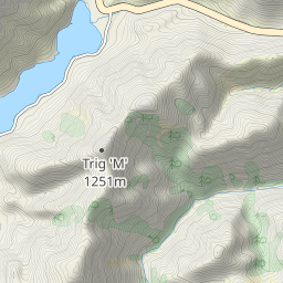
In particular, the Leith Hill Track to a viewpoint on the side of Leith Hill (also known locally as “the Depression” or “sinkhole”) offers great views back over the village and indeed the whole Castle Hill Basin. A return track along the south and east boundaries of Thomas Bush makes for a very enjoyable 2 hour loop.
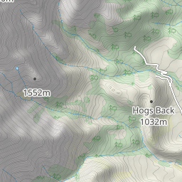
This peak can be accessed from either Coach Stream or Starvation Gully on SH73, and provides panoramic views over Lake Lyndon.
More information is on the DoC website here.
Note: Part of this route is an easement passing through Ben More Station and is closed for lambing from 1 October to 20 November each year. Dogs are not permitted in this section at any time.
Craigieburn Forest
Numerous tracks appeal within the boundaries of the Craigieburn Forest including the following multi-use tracks:
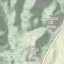
- Dracophyllum Flat Track (a well-benched beech forest track connecting the Broken River & Cheeseman Ski Area roads),
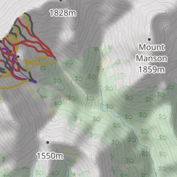
- Camp Saddle (an alpine pass with views into both the Broken River & Craigieburn Valley Basins),
- A circuit via the Sidle 73 Track and up the Craigieburn Valley Ski Area road returning down the Craigieburn Edge Track and over Lyndon Saddle via The Luge to the Broken River road is particularly recommended.
Bikes are not currently officially permitted on the following walking tracks:
- Mistletoe Track (direct track from Broken River campground to Lyndon Saddle),
- Helicopter Hill Track from Lyndon Saddle.
- Camp Saddle.
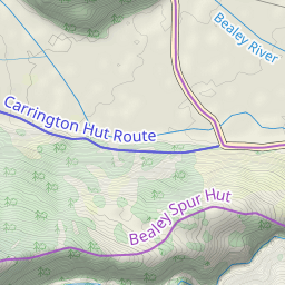
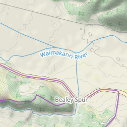
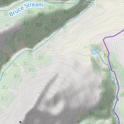
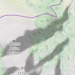
Bealey Spur
The 11km return walk to Bealey Spur Hut (an old 4-bunker with an open fireplace nestled in an open beech forest clearing) provides a relatively easy tramp past a number of small alpine tarns with stunning views to the peaks at the head of the Waimakariri River and across to those in Arthurs Pass National Park.